Southern Maine is home to some of America’s oldest lighthouses. Some of the lighthouses are accessible from the mainland. Others are on islands; so, while they are visible from the shore, you need a boat to see them up close.
Live-in lightkeepers once staffed these lighthouses. However, nowadays, the lights are automated. Also, the US Coast Guard is responsible for the actual light. However, with regard to the lighthouse properties themselves, that responsibility falls to local governments or nonprofits.
We tried to visit as many of these lighthouses as we could so we could share our pictures of lighthouses in Maine. In fact, we may just publish a separate article that’s all about pictures of Maine lighthouses.
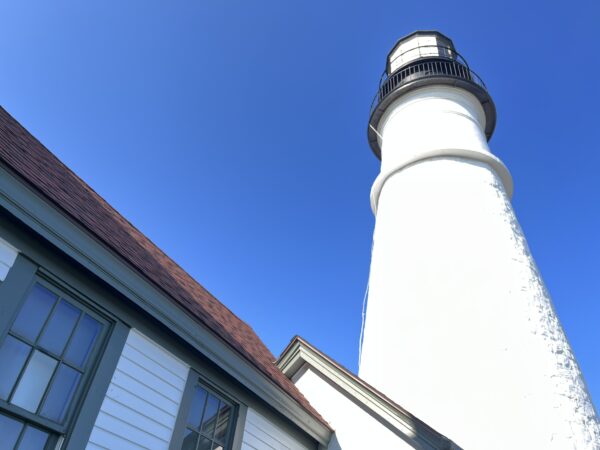
How to see Maine lighthouses up close
If you don’t own a boat, but wish to have a better look, many local boat charters will sail by the lighthouses. Simply Google the name of the lighthouse and “boat charter.” Charters can include a marine mammal watching component as well. Expect to pay about $75 per person for a boat trip.
Also, most lighthouse towers are open to the public to tour only once a year in early September. In 2024, the date is September 14 for Maine Open Lighthouse Day. It’s one of the activities we have listed in our article about free things to do in Maine.
Whaleback Light

Built in 1872, the 75-foot tall Whaleback Light guides mariners to the entrance of the Piscataqua River from the Atlantic. In case you don’t know, you cross the Piscataqua River as you enter Maine from New Hampshire.
The light is on an Island, so unless you have your own boat or take a charter boat, you must view this site from afar. The best venues to see the park are from the sites of several old forts that once protected the Piscataqua River from invasion. This includes two parks in Maine as well as a location in New Hampshire, which we’ve listed below.
Fort Foster Park
The best view of the Whaleback Light is from Fort Foster Park. This park, named for Civil War General John G. Foster, is town-run. Kittery is responsible for its upkeep. Residents pay $20 per carload.
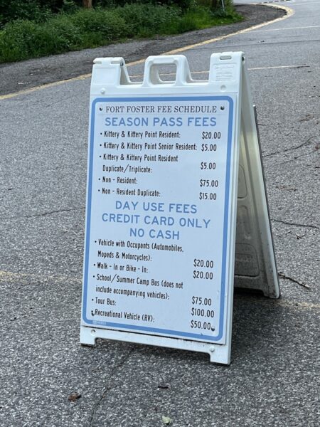
Along with views of the lighthouse, you can visit the old fort batteries and hike miles of trails. Fort Foster controlled a net during WWII that protected the Piscataqua from German submarines.
In season there are bathrooms. Off season, there are port-a-johns.
Fort Foster is home to one of Southern Maine’s dog-friendly beaches. Your four-legged friends are welcome on all of the beaches except the South Pier beach.
Fort Foster Park is located at 51 Pocahontas Rd, Kittery Point, ME.
Fort McClary State Historic Site
From the site of this 275-year-old fort, named for Major Andrew McClary who died at Bunker Hill, you can see both the Whaleback Light. Admission to the Park is $4 for out-of-state adults ($3 in state) and $1 for kids under 12 and out-of-state seniors. In-state seniors are free. During the off season, you’ll find limited services and open facilities. Therefore, we recommend visiting during the summer tourist season.
Note: from this vantage point, you can also see the Portsmouth (NH) Harbor Light House. It’s the one that’s closer and to the right. Pretty, yes, but not one of the Maine lighthouses.
Fort McClary is located on Pepperrell Rd, Kittery Point, ME.
View from New Hampshire
The best free view of the Whaleback Light is actually from New Hampshire. You’ll need to head to the Fort Stark State Historic Site in New Castle. Fort Stark is located at 211 Wild Rose Ln, New Castle, NH.
In addition to Fort Stark, the view from the Great Island Common in New Castle NH is fantastic. Off season the park is free. In season it costs $15 per car load. Great Island Common is located at 301 Wentworth Rd, New Castle, NH.
Boon Island Light

At 133-feet tall, the Boon Island Lighthouse is the tallest in all of New England. It is located about six miles off the coast of York, on the rocky 2100-square-foot Boon Island.
A big part of the Boon Island history is the 1710 grounding of Nottingham Galley, a British merchant ship. The 10 survivors of the wreck had to resort to cannibalism to stay alive. They were shipwrecked for 24 harsh winter days and nights. This sensational story sparked talk of a lighthouse on the island. Eighty years later that idea came to fruition.
After the first lighthouse failed structurally, they built a new version of the lighthouse in 1855. Today, the lighthouse, which is privately owned, runs on solar power.
Because of its distance from shore, you may have a hard time seeing the Boon Island Lighthouse. However, you may be able to catch a glimpse from Long Sands Beach and Sohier Park (adjacent to the Nubble Light). Both are in York.
Nubble Light
Also known as the Cape Neddick Light, the Nubble is one of Maine’s most scenic lighthouses, in our opinion. Located on an island just yards from the mainland, the views are extraordinary. The lighthouse dates to 1879. Even though it’s not occupied, the adjacent keeper’s house is intact.
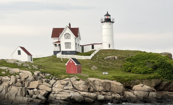
While you can’t go to Nubble Island, the views from Sohier Park are up close and great. Also, make sure you look out to sea to catch a glimpse of the Boon Island light about six miles to the southeast.
In season, visit the gift shop in the park. All proceeds support lighthouse and park upkeep.
The light is only 41 feet tall, but its positioning on a high point on Nubble Island places it 88 feet above sea level.
Some consider The Nubble to be the quintessential example of a New England lighthouse. In fact, NASA included its image in the spacecraft Voyager I in 1977, among other images of human creation on Earth. This included the Taj Mahal and the Great Wall of China.
Imagine: The Nubble among some of these seven wonders of the world. That’s amazing.
Whenever we go to the Nubble, we stop by Fox’s for a Maine Lobster Roll. There is ample free parking near Fox’s and at the park.
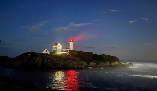
We went back again at night and were able to capture this picture. This might end up hanging on our wall, we love it so much.
Goat Island Light
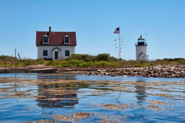
After visiting the shops in Kennebunkport, take the five minute drive from Route 9 (School Street in Kennebunkport and Main Street in Cape Porpoise) to Pier Road on Cape Porpoise in order to take in the view of the Goat Island Light. In season, we like to enjoy a Maine lobster roll at the Chowder House while enjoying the sights.
Construction started in 1833 and was finished in 1860. The light stands 25-feet tall and is about a mile offshore.
In response to requests from local fishermen who had to navigate Cape Porpoise’s challenging waters, the Goat Island Light remained manned until 1990. After that time, it became automated.
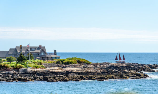
The light house has even played a part in national security. Legend has it that the Secret Service set up shop there to keep watch on the Bush family compound at Walker’s Point.
Wood Island Lighthouse
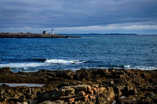
The Wood Island Lighthouse has guided seafarers along the Gulf of Maine, off Biddeford, since 1808. The current tower was completed in 1858. It stands 45 feet tall.
The best views of the Wood Island Lighthouse are actually on the Island itself. During the summer, you can book a guided boat ride and tour of the island for $35 ($20 for those under 13). Unfortunately the tours book up fast.
The second best view requires some hiking along the trails of the East Pint Audubon Sanctuary in Biddeford Pool at the end of Lester B. Orcutt Boulevard. Parking is limited.
You can also drive along Hills Beach Road in Biddeford to take a look. Don’t make the same mistake that we did when we first drove Hills Beach Road, looking for the lighthouse.
The Wood Island Lighthouse is the white building to the east. However, closer to the land is the Stage Island Monument.

The Stage Island Monument history is simple: it was designed to help captains navigate the area. Originally, it was painted white, but has returned to its natural stone color. It’s about 50 feet tall and was completed in 1825. The monument’s construction was mired with tragedy. An earlier version collapsed, killing or maiming several workers.
Anyway, we spent our entire time photographing the Stage Island Monument, including the image above, thinking it was the Wood Island Lighthouse. Oops.
Two Lights at Cape Elizabeth
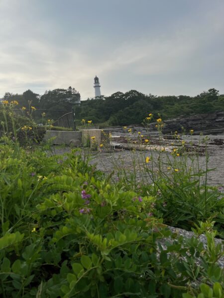
From 1828 on, from the water, you could see two lights on the shore of Cape Elizabeth, thus the name Two Lights. However, there really are two lighthouses here.
The eastern tower shone a continuous light. The western tower’s light flashed.
These two beacons were designed so sea captains could triangulate their location along the hazardous ledge and shoals in the area.
Today, the eastern tower still shines. While the west tower remains, they shut off the light in 1924. They are about a mile away from each other. So it’s nearly impossible to capture them in the same picture or the same place from land.
The Wreck of the Australia
Like many Maine lighthouses, Two Lights has its lore. The best known story occurred on January 28, 1885. During a fierce winter storm, the schooner Australia laden with 150 barrels of mackerel and blocks of ice bound from Boothbay to Boston ran aground along the rocks near the eastern lighthouse. The storm was so strong and the fog so deep that no one noticed for hours. The ship’s captain washed away and drowned, but the two crewmen clung to the masts.
Eventually, lighthouse keeper Marcus Aurelius Hanna (who should be famous just for his name) and assistant keeper Hiram Staples began a rescue. During the rescue, Hanna risked his life by climbing across the rocks and wading into the water in subzero temperatures to get a line to the sailors.
For his valor, he received the Gold Lifesaving Medal, the nation’s highest honor for this type of bravery. Hanna, who also fought in the Civil War, also received the Congressional Medal of Honor for his actions at Port Hudson, Louisiana during the war. He is the only person to receive both medals.
Visiting Two Lights
In season, our favorite spot to visit Two Lights is at the Lobster Shack at Two Lights (225 Two Lights Rd, Cape Elizabeth). On the left you have a great view of the eastern tower. On the right, you get panoramic views of the rugged coast. You can sit there and imagine the power of the raging ocean and Hanna’s bravery when the Australia hit the rocks on that stormy evening.
Use the address for the Lobster Shack to navigate to the best view of the eastern tower.
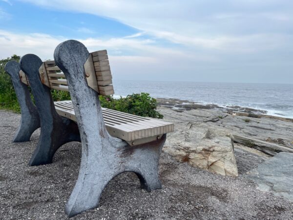
If you want to spend the day and enjoy hiking along Maine’s rocky coast, consider a trip to the 41-acre Two Lights State Park. Admission to the Park is $7 for out-of-state adults ($5 in state) and $1 for kids under 12. Out-of-state seniors cost $2. In-state seniors are free.
On New Year’s Day, you can take a First Day Hike at Two Lights.
Portland Head Light
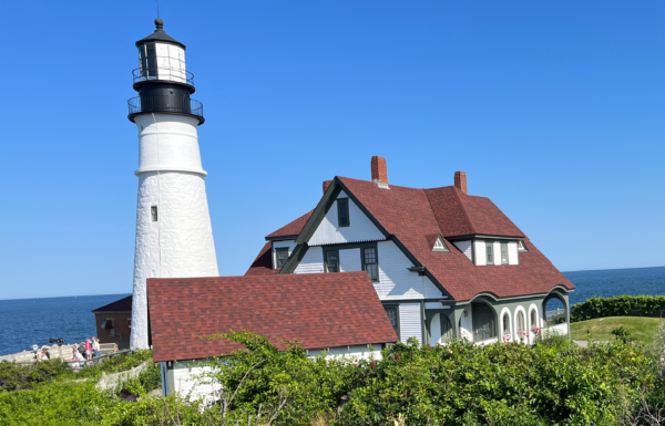
The Portland Head Light is the oldest of Maine’s lighthouses. It dates back to 1791.
That’s when George Washington commissioned it. Eventually, he dedicated it to the Marquis de Lafayette. (Cue the “Hamilton” soundtrack.)
At that time, the light was 72 feet tall. Sixteen lamps, fueled with whale oil, created the light. Later renovations made it 80-feet tall.
Why do we call it the Portland Head Light? Well, it is named for the land upon which it is built.
That’s known as the headland because of its sweeping views of the harbor. Why Portland if the Portland Head Light is in Cape Elizabeth? Because at the time the lighthouse opened, the area was, in fact, Portland.
Until 1989, the lighthouse keeper lived on site. Since then, the lighthouse has become automated.
Fort Williams
Fort Williams has a rich history of its own. For instance, the military used the headland of what is now known as Fort Williams Park as a lookout point during the American Revolution. In subsequent years, they enlarged it into a fully functioning military installation. That’s when, in 1899, it got the name Fort Williams.
Also, Fort Williams was active during both of the world wars. At that time there was a battery with cannons and anti-aircraft guns.
A few years after decommissioning, the Town of Cape Elizabeth purchased Fort Williams and turned it into a public park. However, if you’re interested in the military history, check out Battery Blair, near the main parking lot. Sadly, these days, you have to go past a line of port-a-potties to get to Battery Blair.
From the park, visitors can also see the remains of Fort Scammell (from the period around the War of 1812) and Fort Gorges (from just before the Civil War). Fort Gorges has the same design as Fort Sumter, the site of the first Civil War battle in South Carolina.
Visiting Fort Williams Park
You’ll pay to park closest to the Portland Head Light. We paid $5 for two hours via an on site meter. However, the park’s overflow lot (near the children’s garden) is always free.

Near paid parking, you’ll find EV charging stations. Also, Fort Williams Park is dog friendly.
All told, the last time we visited the Head Light, there were three food trucks there. The two closest to the lighthouse are Cousins Maine and Gorgeous Gelato. Cousins, which you might remember from their Shark Tank segment, takes credit cards. The gelato food truck is cash only.
Further inland in the park is the Bite into Maine food truck. Bite into Maine’s wasabi lobster roll is one of my favorite bites in all of Maine.

If you go for lunch, the lighthouse museum and shop, located in the former keeper’s home, is open weekdays from 10-2 and weekends from 10-4. It costs $2 for adults and $1 for kids ages 6-18.
Finally, to navigate to the Portland Head Light or Fort Williams Park, use this address: 1000 Shore Rd, Cape Elizabeth.
Ram Island Ledge Lighthouse
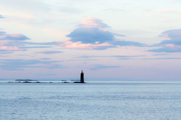
Ram Island sits just over one mile from the shore. The lighthouse was built in 1905 after numerous wrecks along the northern edge of the channel leading into Portland.
This lighthouse is 72-feet tall and, like so many retrofitted lighthouses these days, is solar powered. Your best vantage point for viewing the Ram Island Ledge Lighthouse? Fort Williams Park near the Portland Head Light. Look straight out into the water and, hopefully on a clear day, you’ll see it.
Halfway Rock Lighthouse
Halfway Rock Lighthouse sits on Halfway Rock. It is Casco Bay about halfway between Cape Elizabeth and Cape Small in Midcoast Maine.
This lighthouse, built in 1871 of white granite, is 75-feet tall.
Some consider Halfway Rock to be so remote and dangerous that when there were lighthouse keepers working it, they weren’t allowed to bring their families. Well, the lighthouse keepers are no more. These days, private philanthropist Ford Reiche owns it.
It’s about 10 miles off shore and, given this location, it’s best viewed by boat.
Spring Point Ledge Lighthouse

The Spring Point sits adjacent to what was once Fort Preble, an early 19th-century battery that protected Portland Harbor. It was decommissioned after WWII and is now home to Southern Maine Community College. SMCC is one location for New Year’s Day Polar Bear Plunge events.
Built in 1897 the Spring Point is a short and squat (54 feet tall) lighthouse. It’s called a spark plug style light, so named because of its shape.
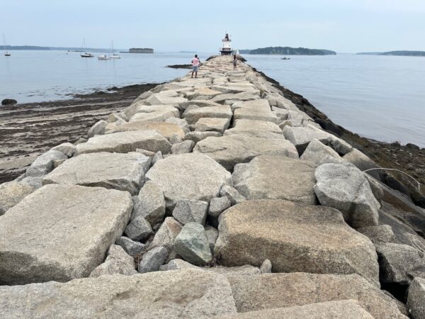
You can actually walk out to the light via a stone breakwater. You access this from the ruins of Fort Preble. There is a small staircase. However, the rocks on the breakwater are uneven. For this adventure, we recommend closed-toe shoes with a good grip. Please leave the flip flops and heels at home.
To get to the Spring Point Ledge Lighthouse, navigate to the end of Fort Road on the college campus. Parking is free but limited. On the day we visited, we had to wait for someone to leave one of the visitor spots in order to park.
Also, there is a small gift shop that is open on weekends in season. The views of Forts Gorges and Scammell are great — even from the shore.
Portland Breakwater Light
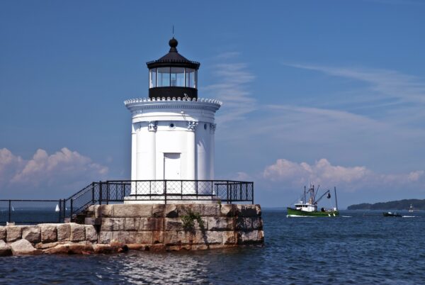
Less than a mile from the Spring Point Ledge Lighthouse is another Portland lighthouse called the Breakwater Light. However, most people call it the Portland Bug Light. Why the bug light? Because it is quite short — just 25-feet tall.
Unlike most traditional lighthouses, you’ll notice something quite different about the Bug Light. That’s because it has an elegant Greek Revival style.
The first light was built in 1855. The current structure was completed in 1875.
The light sits at the end of Bug Light Park in South Portland and can be accessed there. Because of landfill in the area, the light now sits adjacent to the shore. When it was built it was not as close.
Finally, Bug Light Park is dog friendly. To get here, navigate to the South Portland Historical Society, 55 Bug Light Park, South Portland.
Free and Cheap Things To Do in Southern Maine This Week
Here are FREE and cheap things to do in Southern Maine in the coming week.
Leave a Reply